Severe Weather Outlooks, Watches and Warnings are issued by MetService, Te Ratonga Tirorangi, New Zealand’s National Weather Service. They are available through radio, television, the MetService website and mobile app, by registering for email, via radio and television, also on social media from @MetService on Facebook and Twitter.
Typically, MetService will issue advice six days out from potential severe weather through a ‘Severe Weather Outlook’. This applies to large areas of rain, wind and snow. The Outlook is a “heads up” that although severe weather is coming, there is some uncertainty about what might happen and where.
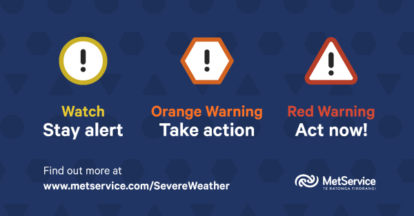
As an event gets closer, MetService can be more specific about severe weather timing, location and intensity. MetService will issue a ‘Severe Weather Watch’ (with colour-code Yellow) or a ‘Severe Weather Warning’ (with colour-code Orange or Red depending on the severity of the event).

- Severe Weather Watch – Yellow: Bad weather is coming or getting closer. Either the weather will be substantial, but not serious enough to reach ‘warning’ criteria, or MetService are more confident about what might happen but there is still some uncertainty. Watches are issued as required for events expected in the next 48-72 hours, or issued for events expected in the next 24 hours where uncertainty is high.
- Severe Weather Warning – Orange: MetService are confident about what is going to happen. They warn about when and where warning criteria will be reached and the impacts of this weather will be significant.
- Severe Weather Warning – Red: This event is extreme and is among the worst that we get – it will have substantial impacts and it is possible that a lot of people will be affected. This may be similar to Cyclone Gita in February 2018, the Fiordland/Southland floods of February 2020, the Canterbury flood of May 2021, or the Buller flood of July 2021.
Thunderstorms are different. They form incredibly quickly and are less predictable. At most, a “heads up” Thunderstorm Outlook is issued up to 36 hours before the event (covering ‘today’ and ‘tomorrow’), and a Severe Thunderstorm Watch is typically issued within 6-12 hours of the event. Severe Thunderstorm Warnings are issued once a severe thunderstorm is observed on weather radar and provide information on where the storm will move in the next 60 minutes. Because a severe thunderstorm has the potential to cause substantial impacts, damage and disruption, a Thunderstorm Warning will always be depicted with a Red colour-code.
Learn more about MetService Severe Weather Outlooks, Watches and Warnings on the MetService website.

